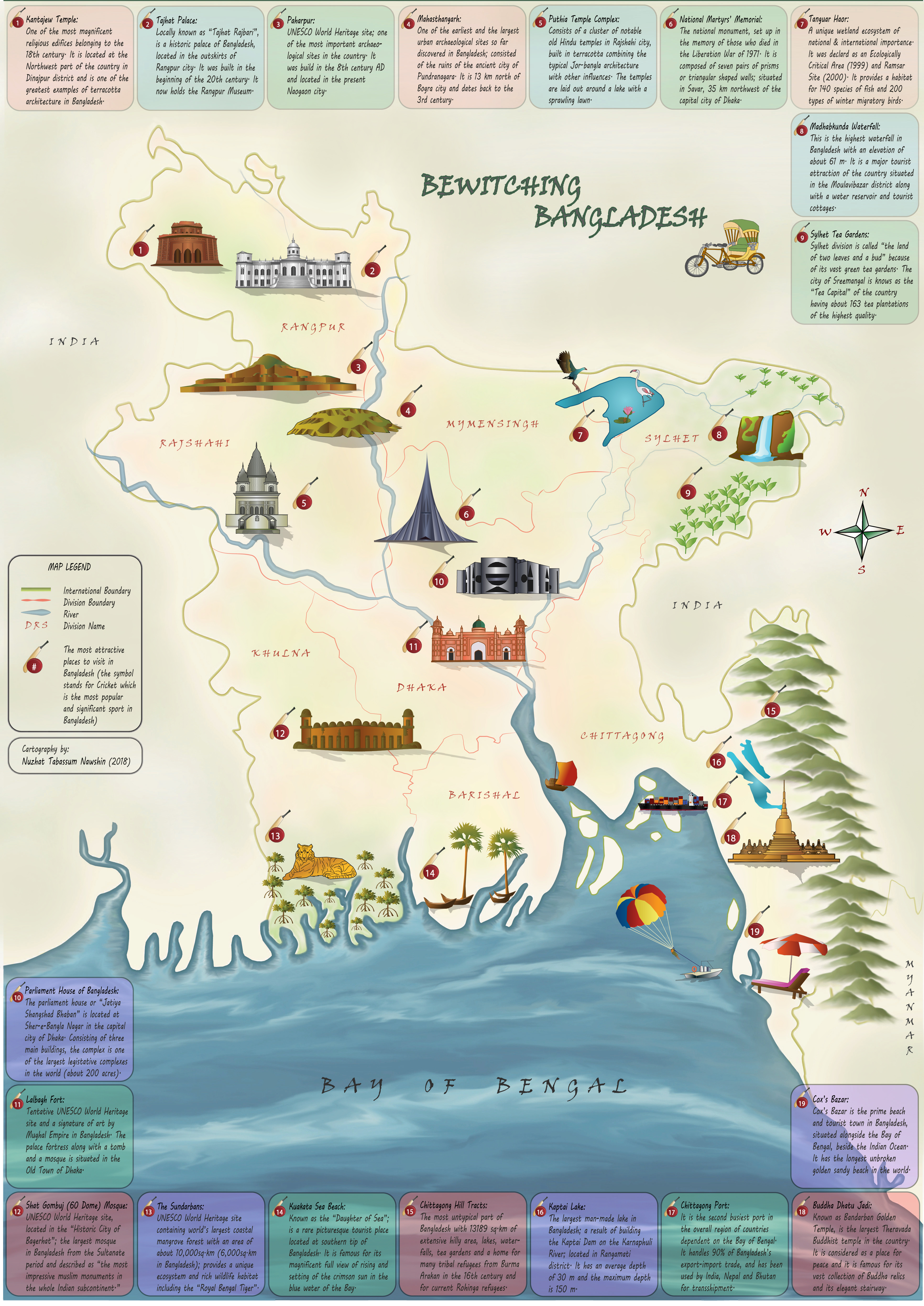
Bewitching Bangladesh
Tools: Adobe Illustrator, Adobe Photoshop, ArcMap
This mapping project was a beginner’s attempt to showcase the beauty of my homeland. In my second semester as a cartography student, I wanted to make a aesthetically pleasing printable map for my Project Map Design course at the Technical University of Vienna (2018). It held significant importance for me as I always felt that Bangladesh, being a third-world developing country grappling with numerous socio-economic and environmental challenges, lacks a captivating visual representation that it rightfully deserves.
This was also my very first attempt to use Adobe Illustrator and Photoshop. Using Illustrator, I crafted 3d illustrations of 19 tourist places (both physical and cultural features) across the country, incorporated the country and division borders extracted from ArcMap, simplified linework to enhance clarity and designed the layout, while the nuanced details of water bodies, hilly terrains, and background shading were rendered in Photoshop. Moreover, I designed two symbolic icons emblematic of the country's identity and culture - “Rickshaw” (used with the map title) and “Cricket bat and ball” (denoting the POIs).