Project type
Collaborative research and design project - part of my ongoing PhD research
Deliverables
Locative audio app prototype
Duration
Ongoing project -
Competitive analysis (6 months),
Initial protype and test (6 months),
Content research, script writing and re-designing prototype (6 months),
User evaluation (schdeduled for Spring 2025)
Collaborators
This project is a collaboration between the Wisconsin Sea Grant Institute and UW Cartography Lab (CartLab), involving my PhD advisor, peers, my supervisor from Sea Grant, and myself as the project assistant and research lead.
Responsibilities
- Conducting competitive analysis of similar locative tours
- Leading user evaluation and redesign efforts for route optimization and content structuring
- Developing beta version of the interactive prototype using Leaflet
- Creating educational scripts and soundscapes for an immersive user experience
Tools used
Leaflet, HTML, CSS, JavaScript, Adobe Illustrator (for diagrams and maps)
Urban stormwater management is a critical environmental challenge, yet public awareness of innovative solutions like green stormwater infrastructure (GSI) remains limited. Traditional educational approaches often fail to connect with diverse audiences or showcase real-world applications effectively.
Our main guiding question was:
How can a locative audio tour inspire deeper engagement and understanding of green stormwater infrastructure in Shorewood, Wisconsin?
Competitive Analysis
As a first step, we conducted a comprehensive analysis of existing locative audio apps and storymaps, evaluating features such as usability, engagement strategies, and content depth. This helped us identify:
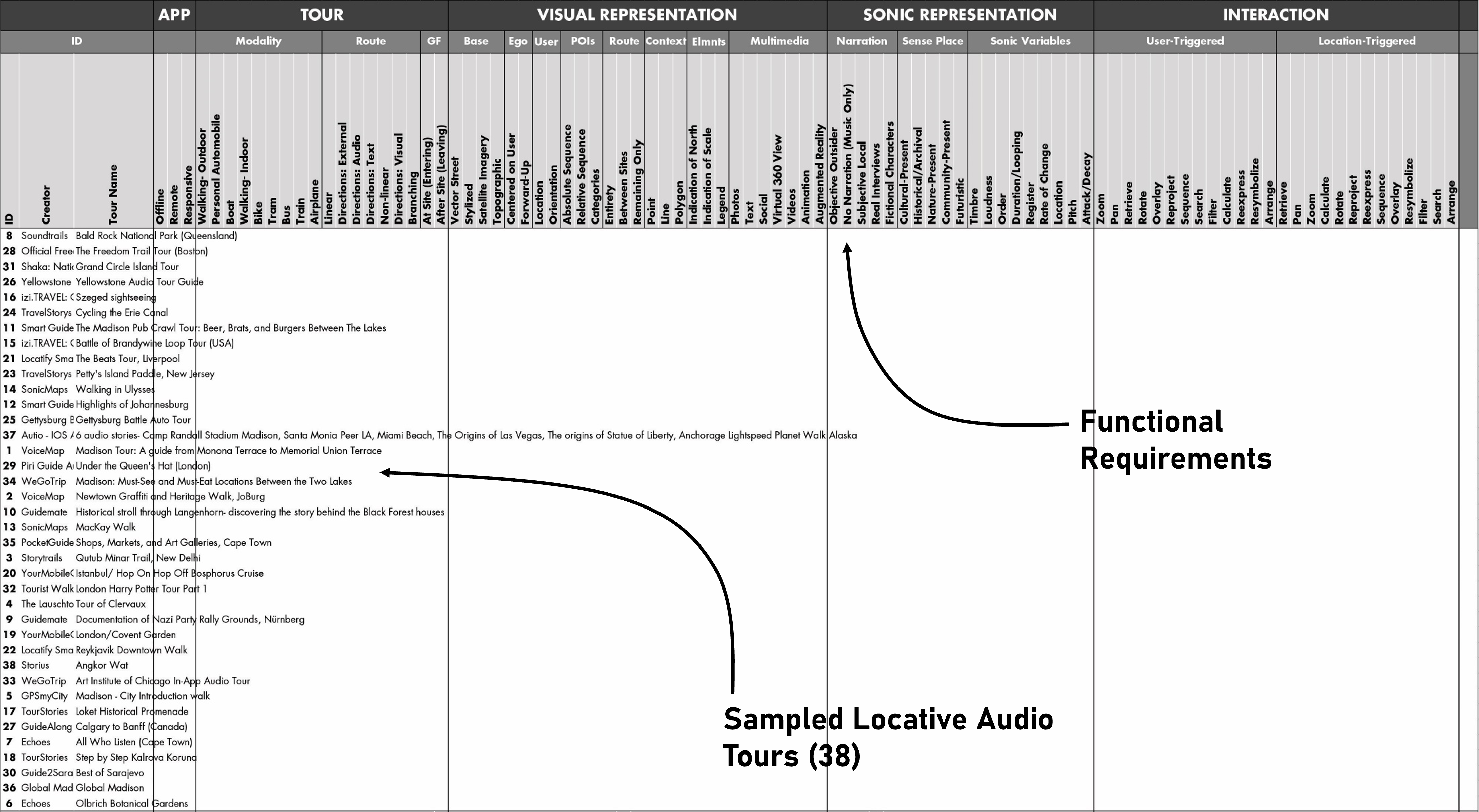
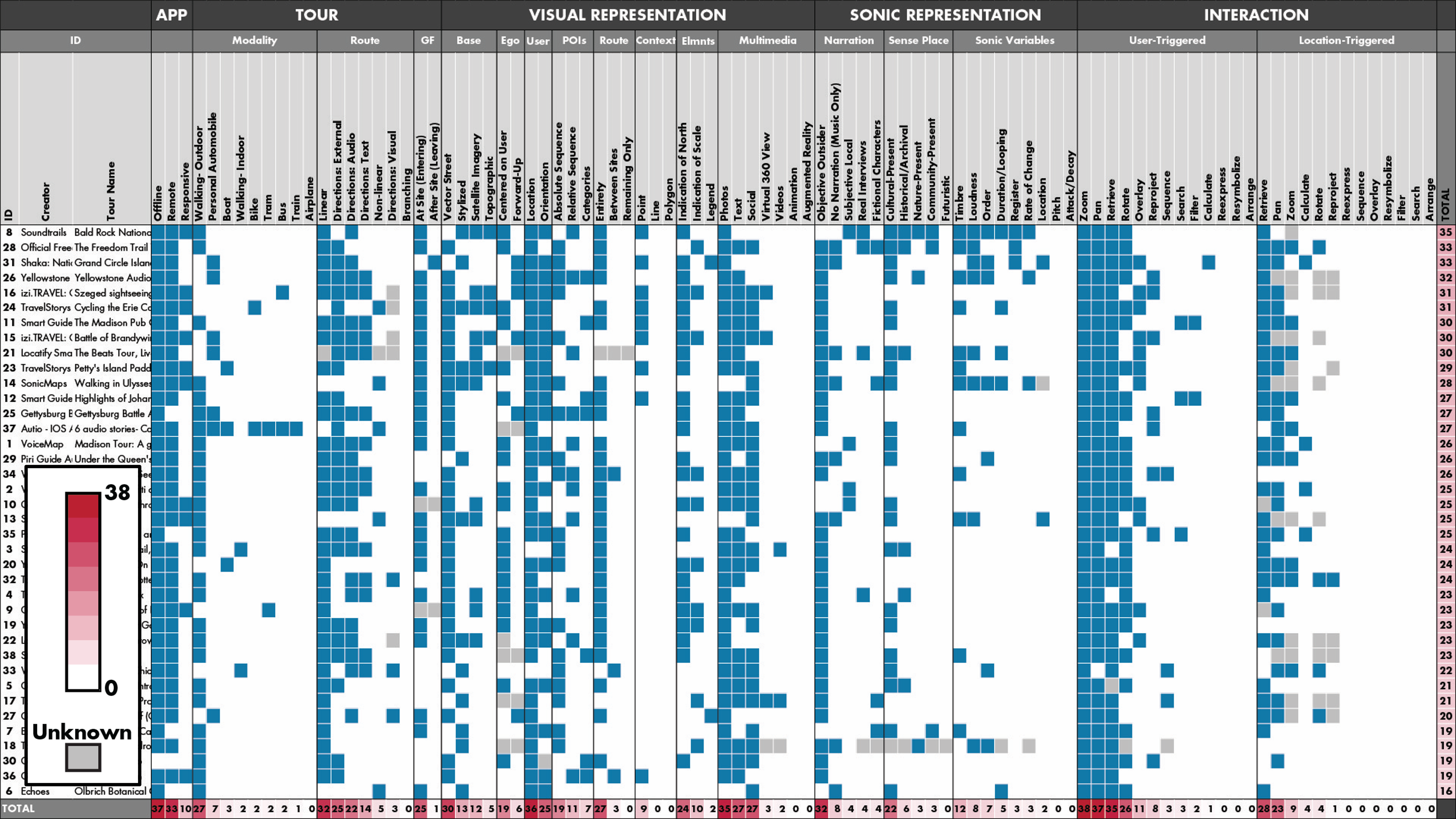
Research Objectives
Target audience
The primary audience includes local residents, students, and tourists interested in environmental sustainability and urban planning.
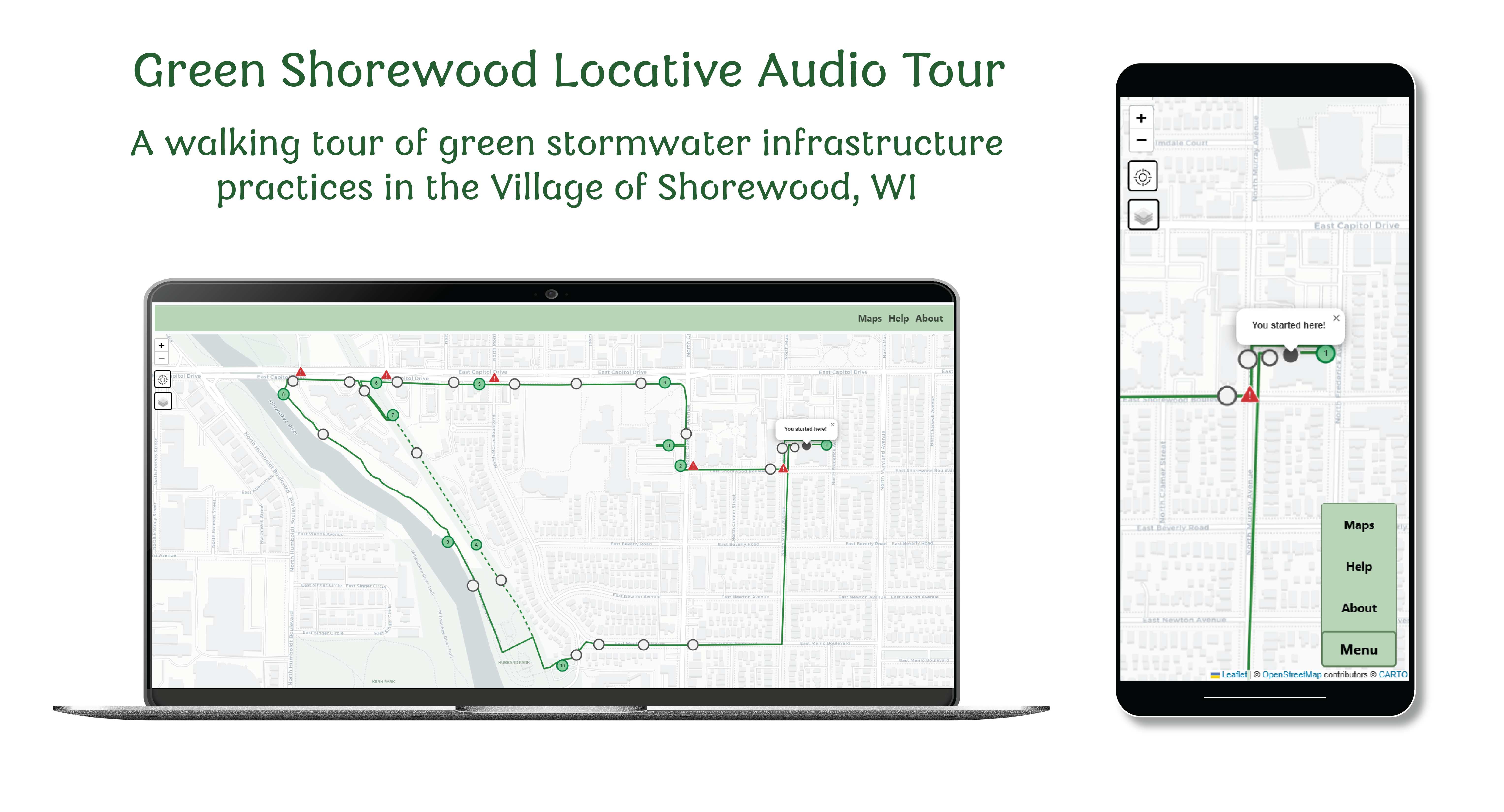
Initial Protypes
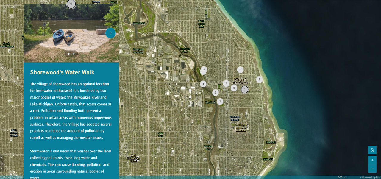
We developed a locative audio mobile guided tour of recent and planned green stormwater infrastructure projects in the Village of Shorewood, Wisconsin. We created three versions of the same tour using VoiceMap and Echoes, apps selected from our competitive analysis samples for their functionalities. We also built our own custom web app using Leaflet.js. The story content was taken from an already existing storymap created by our partners in Milwaukee (https://storymaps.arcgis.com/stories/63a66207e2eb4893a4d1d7f2de654c9d).
Expert Evaluation
Seven collaborators, including myself, conducted a walkthrough of the initial tour using all three prototypes. We evaluated the route and content using a structured questionnaire and focus group discussions. The following map shows the route walked by each of the participants and identifies major pain points during the walk.
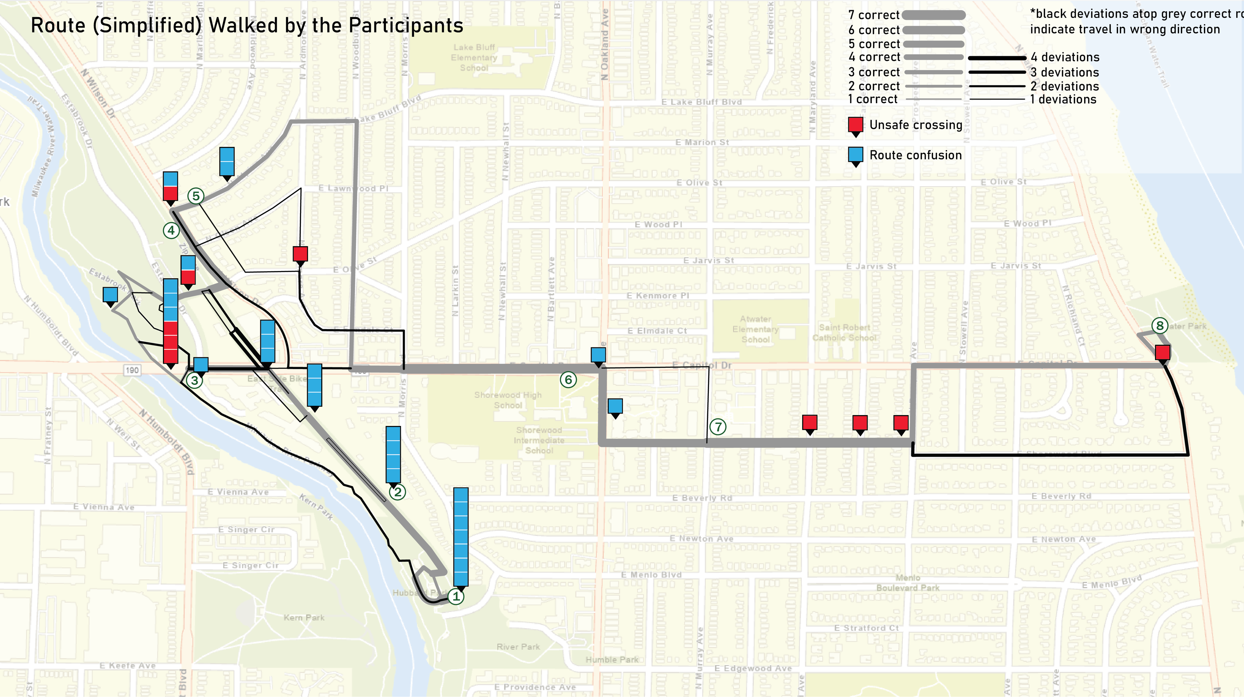
Key recommendations made by the experts included:
1. The need to adjust stop locations and radius for GPS-triggered audio playback for better flow and accessibility
2. Suggestions to re-design the route, refine scripts and using sound for a balanced and memorable experience
3. Recommendations for enhancing navigational clarity and audio-visual aids to make it more intuitive
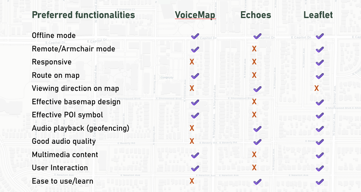
Finding The Best Solution
We also made comparison of the three technologies to find out the best solution for the case study.
Redesigning the Tour
Following the expert evaluation, several strategies were adopted for redesigning the tour:
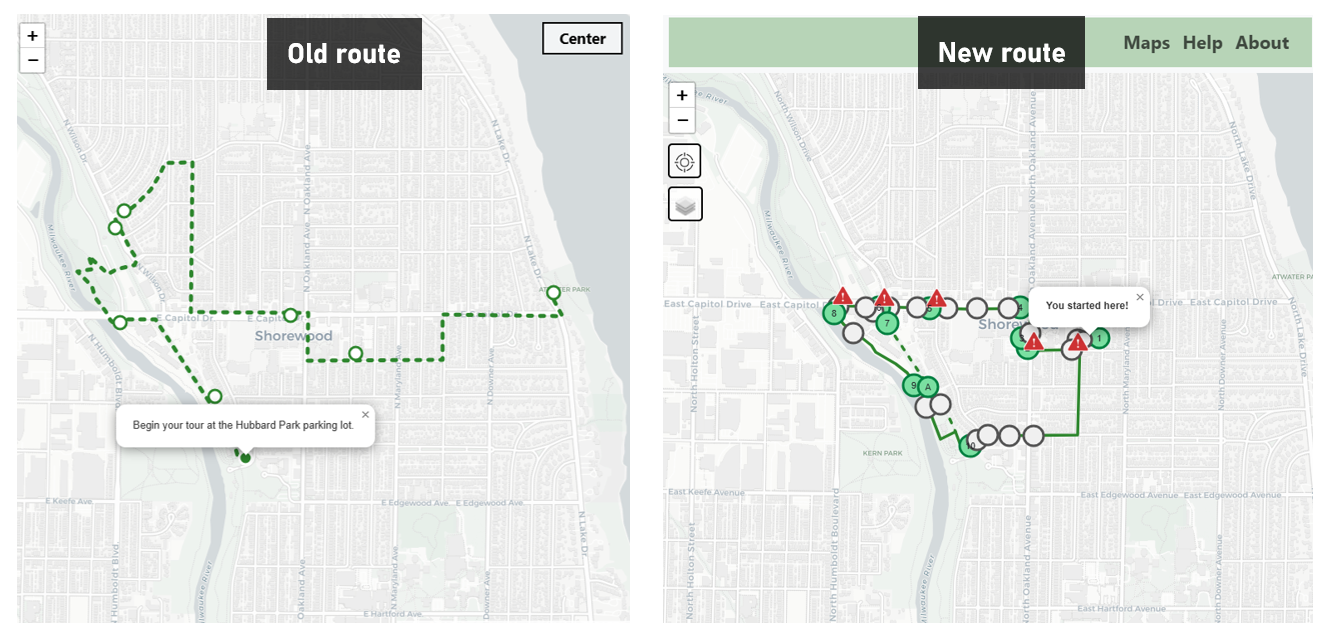
Key Design Principles
Beta Prototype Development
Since the comparison showed that the Leaflet.js prototype gave us more control over the design and functionalities, we developed a beta version of the app using Leaflet, HTML and CSS, featuring:
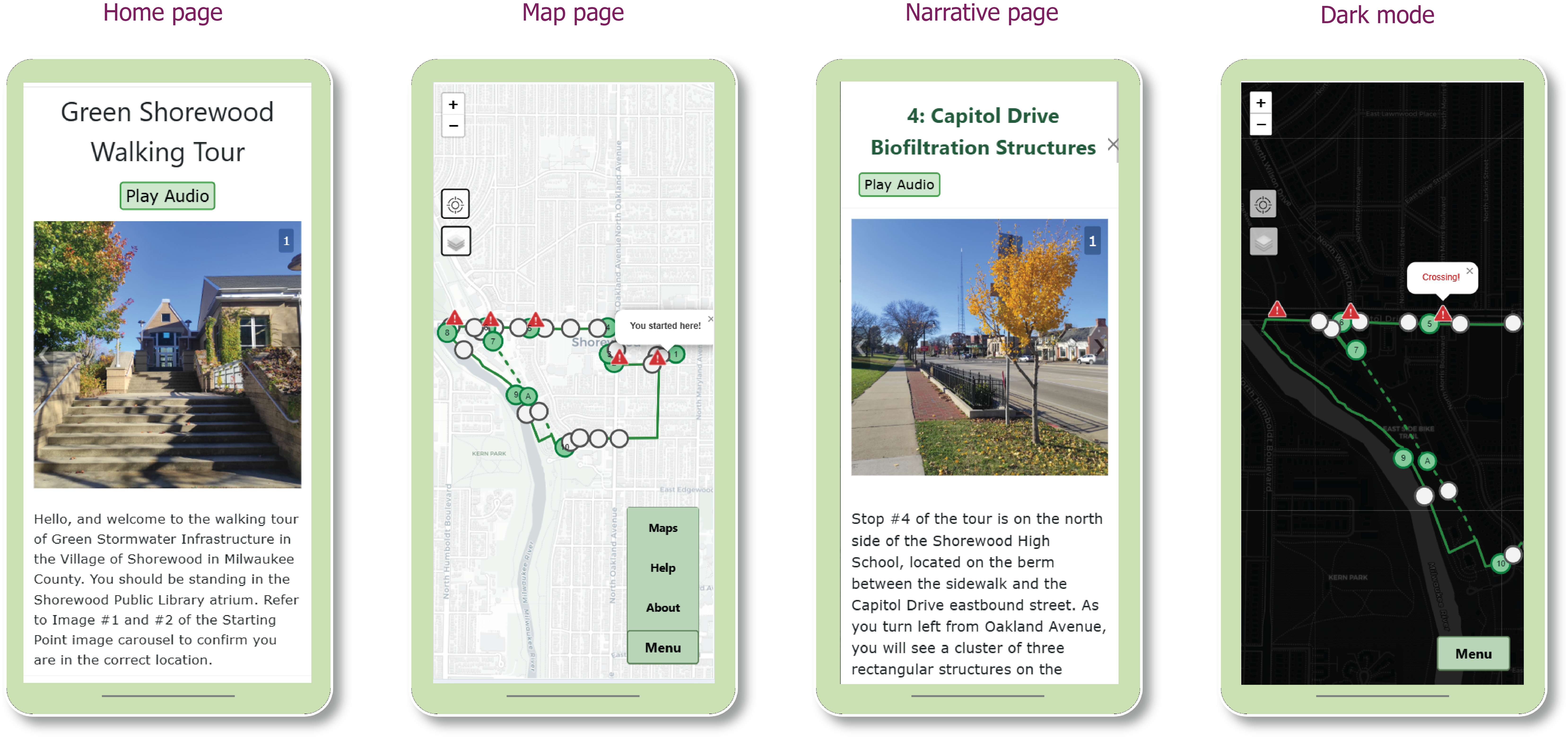
To see the prototype on mobile device, please scan the following code:

To see the prototype on PC, please click on the following link:
While the prototype demonstrates the core functionalities at this moment, it is still in progress. I am currently working on the following tasks:
The following prototype reflects its current state and will continue to evolve through iterative design and development.
Due to winter constraints, user testing with broader audiences is planned for Spring 2025. The study will be conducted with 20 participants and will consist of a 2-hour long walk, thinking aloud and observtion methods, and post-tour questionnaire survey to assess:
This project taught me the importance of blending creativity with structured design methodologies to create meaningful user experiences. I gained hands-on experience in:
While this project is ongoing, it represents my growing expertise in user-centered design and my commitment to making environmental education engaging and impactful.